I love maps – they are fascinating things to explore. And Fortunately, we have quite a few in the archives’ collection! So, since I got into them a bit the other day looking for mining maps, I thought I’d pull out a few of my favourites for you to enjoy, too.
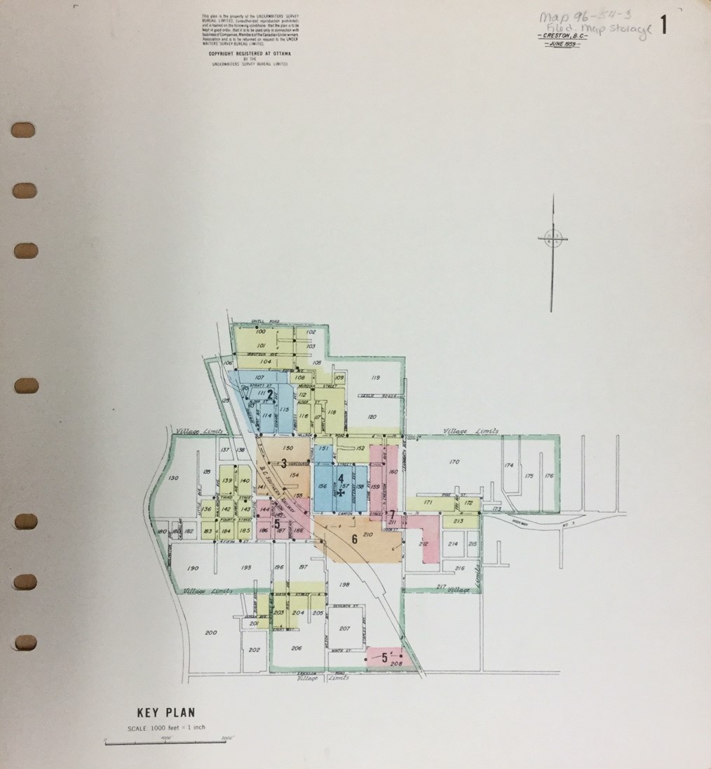
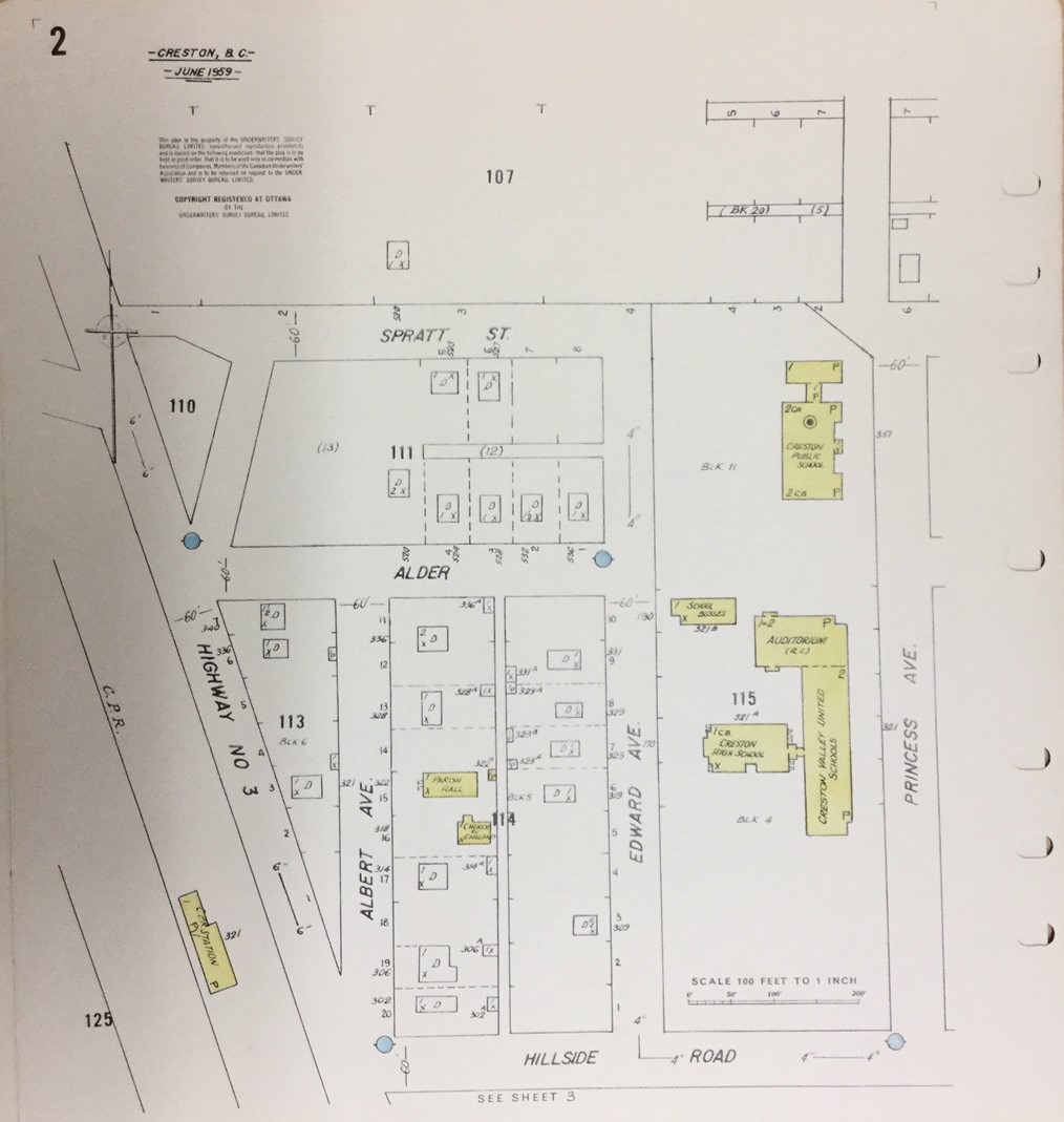
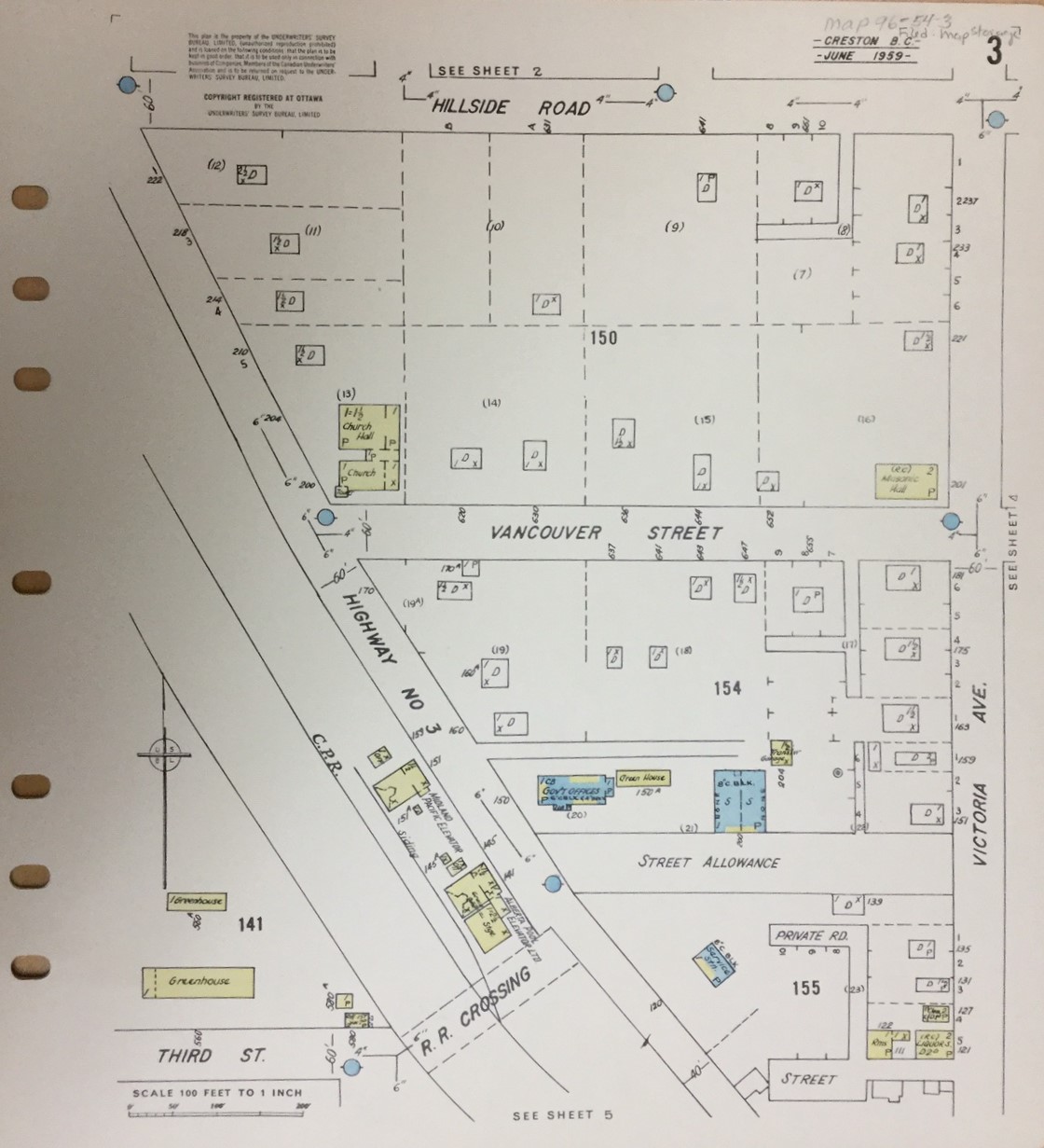
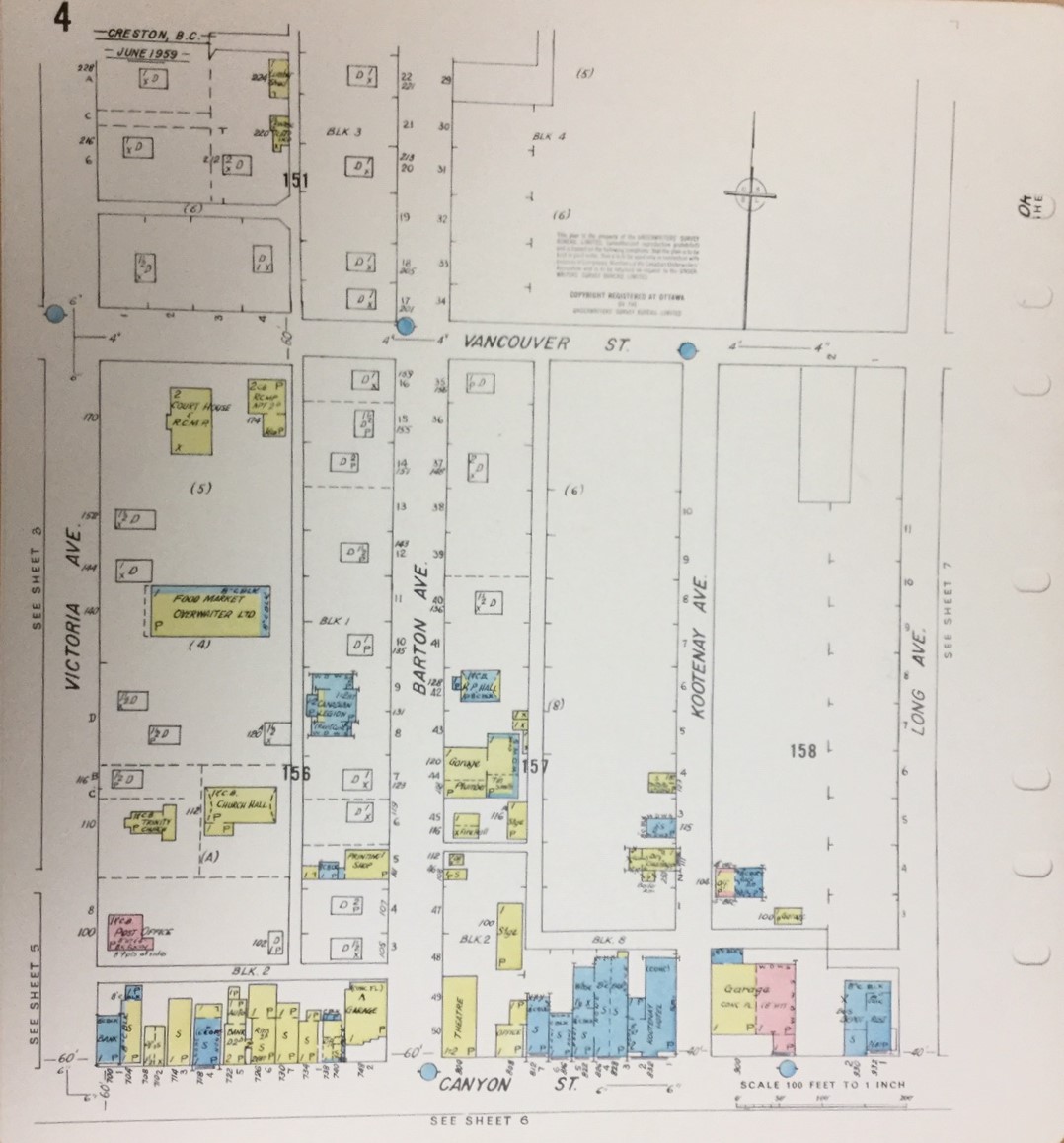
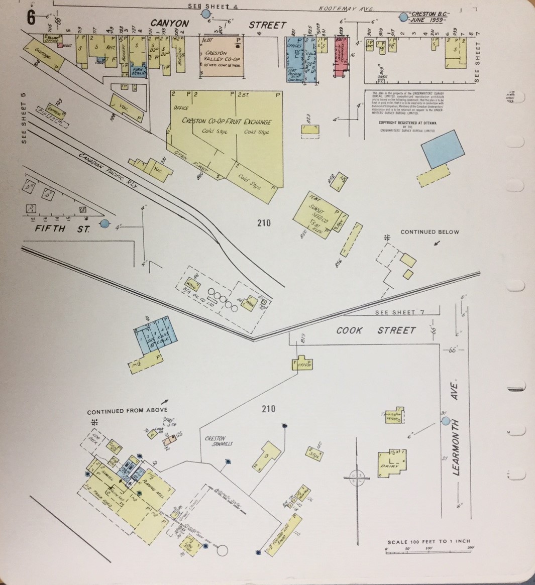
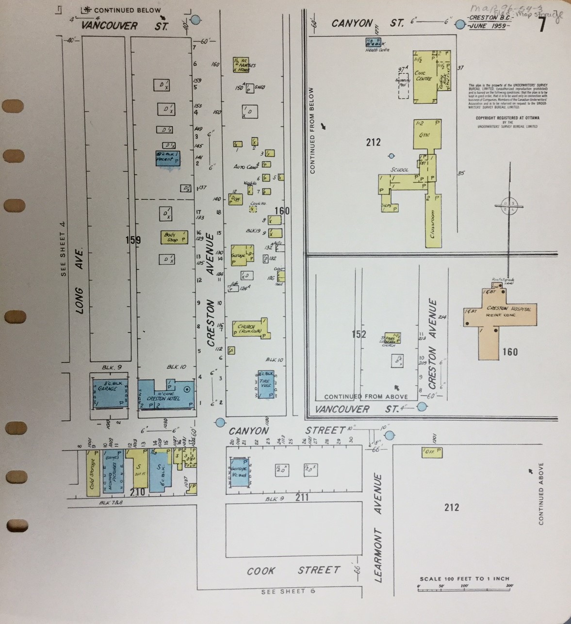
Here’s one: a fire insurance map from 1959. These incredibly detailed maps show the businesses that were located on various properties, the size and position of the buildings on the lots, often outbuildings and auxiliary structures, and even the construction materials. They are wonderful complements to photographs and often help not only to answer questions but to provide new information as well.
We have an earlier set of fire insurance maps – from 1948 – but I chose to include this one because I think it’s a little more within the memory of most of our readers. So – I want to hear your memories! What stories or anecdotes do these maps trigger? Are there any details that surprise you, or remind you of things you’d completely forgotten?
If you’re “much too young to remember 1959,” or for whatever reason weren’t in Creston at the time – Can you place these maps in relation to landmarks you’re familiar with today? Is there anything you see in here that raises your curiosity? I’m sure the ones who do remember Creston at or near this time would love to help us answer your questions!